Washington

Return to Mailbox Part 4 - The Revenant

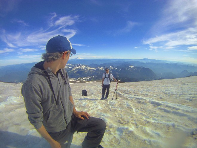
I decided to get my annual hike up Mailbox out of the way early this year instead of putting it off until summer. I’ve done Mailbox in winter and summer conditions and while they both have their own special brands of misery, I still prefer doing Mailbox in winter. The snow does a better job of breaking your falls and even gives you a built in excuse for falling so much, which I’ve always appreciated. 

I don’t have much interest in hiking Mailbox in large crowds, so it was nice to see Mailbox open again on weekdays, even if it’s just until spring when they start paving Middle Fork road again. I’ve heard people had trouble finishing the new trail because of snow and downed trees, but I’ve yet to attempt the new trail and probably never will. I still stubbornly think the old trail is the way mailbox should be hiked and regard (quite unfairly I might add) the new trail as a bit of a chairlift equivalent of reaching the top. So, as always, it was back to the unforgiving old trail for the day.

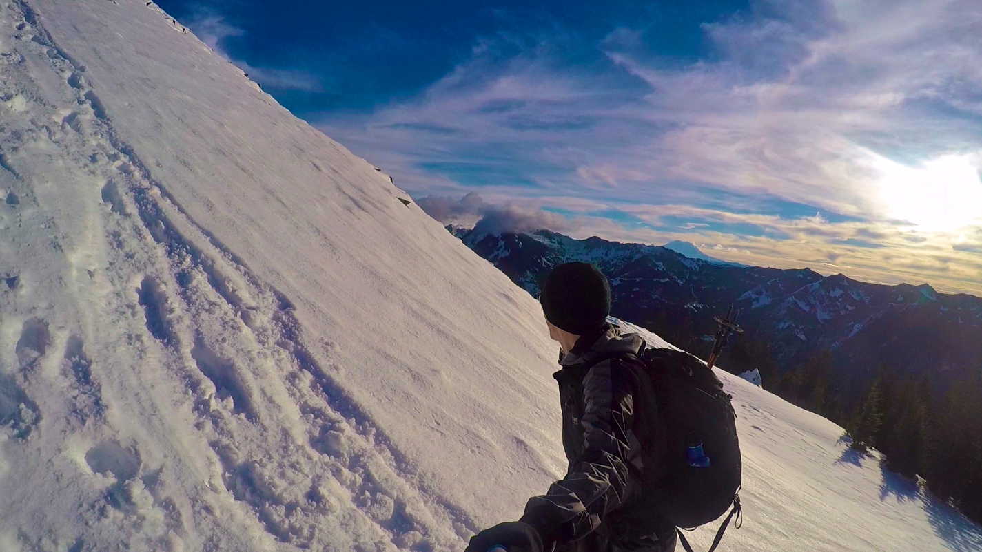
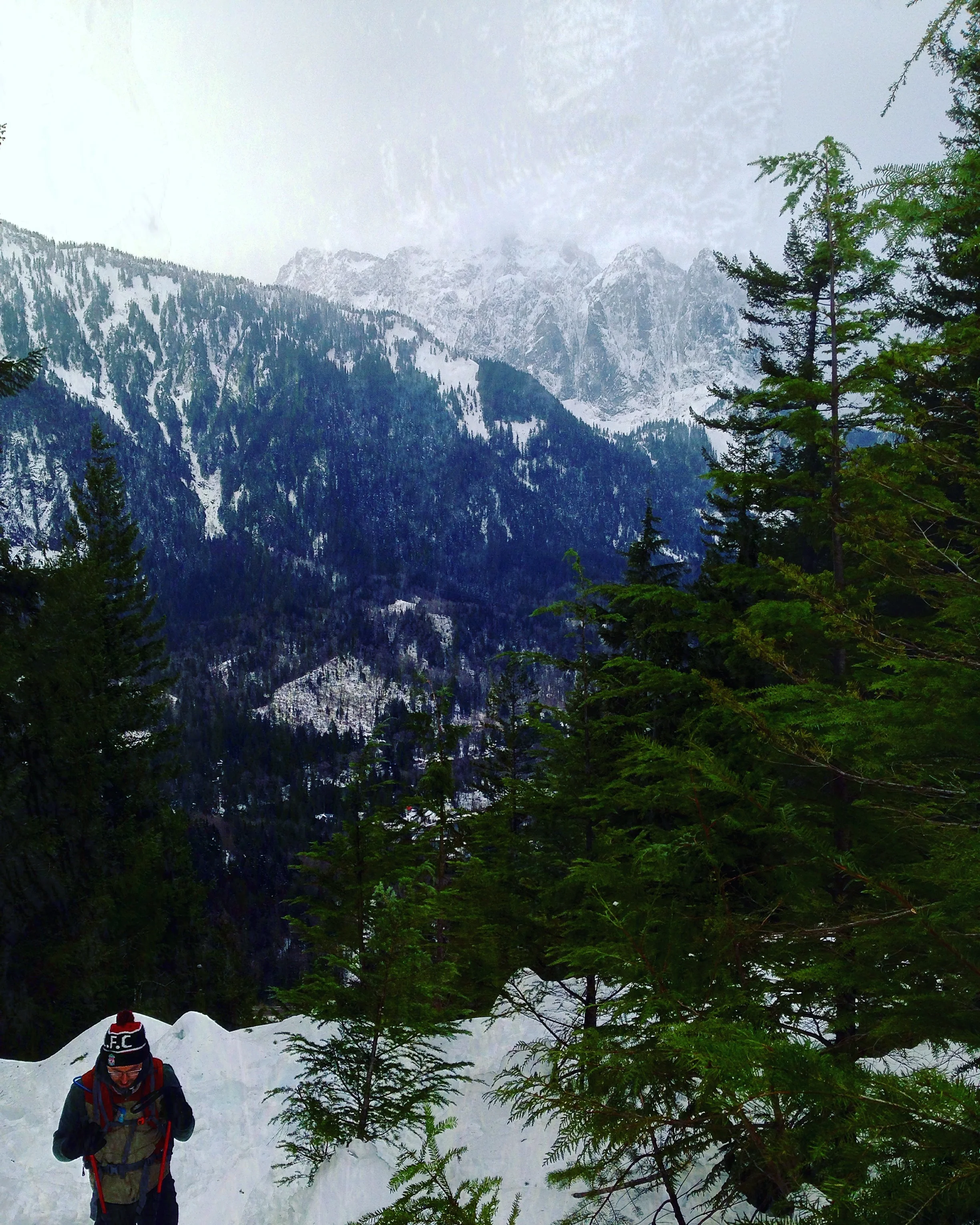
You will encounter patches of snow and ice right as you leave the parking lot. At this point you can slap on your traction devices, but most of the slush will disappear before you reach the trailhead and really won’t make an appearance again until almost a mile into the hike. After that, traction devices (I know yaktracks are popular on the trails, but I feel like Mailbox really calls for microspikes, ice trekkers or crampons) and hiking poles become necessary as the snow and steep elevation gain makes for a difficult climb. The trail also has a few downed trees, especially in the first mile, but the path is generally well tread and easy to follow (if you do lose your bearings, as always try to follow the white diamonds on the trees as beacons for staying on the trail).
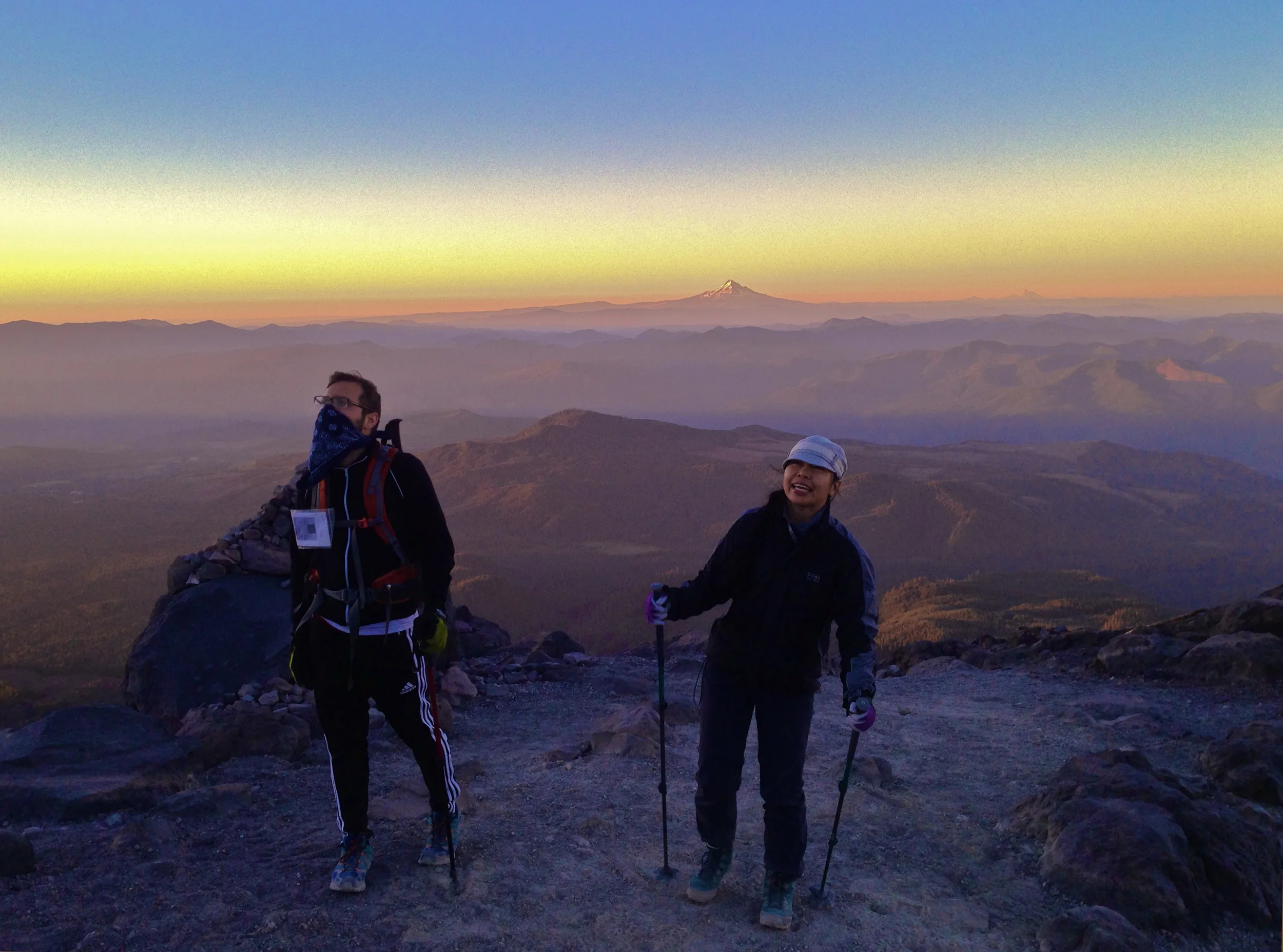
Seattle from afar.

Seattle from afar.

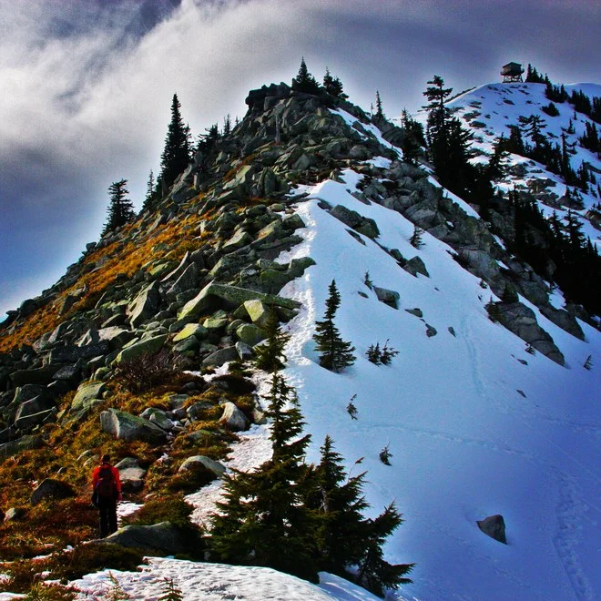
The weather was great, but by the time I hit the boulder field, the temperatures took a nosedive and the wind started to howl. The scree was littered with ankle breaking posthole opportunities, so please be cautious when navigating this section. When I finally reached the top, the conditions were pretty brutal, but I did get a chance to sit down and check the mail. I was pleased to find no bills or jury summons, just booze and hand warmers. I didn’t linger too long at the top because of the conditions and headed back down soon after. Even with crampons and poles, the descent was a bit of a slip slide adventure.

All in all, Mailbox is not without its hardships and special brand of despair inducing grade, but I always find myself returning to its slopes. Great views, solid workout, no bills. Can’t ask for much more.


Hike log:
12:45pm – Left the car

3:25 – Reached the summit

3:45pm – Started back down

6:00pm – Made it back to the car with minimal bruising


Recommended reading for the trail: To Build a Fire

Soundtrack for the trail: The Revenant

Original post on WTA

Heybrook Lookout

I missed our annual New Year’s day hike this year because of work schedules, so today was the makeup date for our group. With the snow piled up in the mountains and a number of trails inaccessible or unstable at the moment, we decided to hike something simple and headed out to Heybrook Lookout. We unfortunately caught the tail end of this weekend’s clear skies, but fresh off seeing ‘The Revenant’, I didn’t mind the landscape looking similarly moody and providing a proper winter ambiance for the hike.

To echo the last few trail reports for the lookout, traction devices and hiking poles are highly recommended. You encounter crusty snow and ice almost immediately off the trailhead and even with the trail’s fairly modest and gradual elevation gain, it is still quite slippery. You can probably reach the lookout without poles or spikes, but I doubt you’ll be pleased with the way you look while doing it. Along with ice and snow, there are still a number of downed trees from the last few storms that you will need to maneuver around, but it’s nothing that can’t be passed with a few agility drills, clever planning or wide berths.
 

It started to flurry a bit by the time we hit the lookout and the staircase up is a bit of a hazard with ice blanketing the steps, but if you take your time, you can navigate them safely. The top of the lookout is locked and inaccessible, but you still get great views of Baring and Index from the false summit just below. It also provides a nice nook to sit and eat lunch while admiring the wonderful view.

All and all, Heybrook Lookout was a great warm up hike for the year. If you get out there early enough in the day, it's a quick excursion that you can pair up with any of its Highway 2 neighbors, especially Lake Serene. Serene, while certainly a beautiful trail in its own right, doesn't quite give you the panorama view that Heybrook provides, making the two a nice complimentary pair in close proximity.

An intimidating looking structure.

An intimidating looking structure.

Either way, wherever you are heading this week, stay safe out there! 

Recommended reading for the trail: Desolation Angels

Soundtrack for the trail: El Condor Pasa

Original post on WTA

Camp Muir Part 2 - If At first you don't succeed, just go hike Mount St. Helens

After some blistering forecasts this past weekend, we were lucky to catch perfect weather for heading up to Camp Muir. This was a pleasant surprise as lately we have run headfirst into some pretty gruesome weather on our hikes (I won’t name any names, but a certain Skamania County volcano may never be getting a Christmas card from me again).

We left paradise around 1:45pm. The Skyline Trail was bustling as always and was crowded until Glacier Vista, where the foot traffic generally tends to thin out. The marmots were out snacking in the meadows and while the wildflowers have paled, they still provide wonderfully scenic landscapes for your trip up the mountain.

When we broke off the Skyline Trail for Pebble creek, we heard some reports of crevasses opening up on the Muir snowfield. We didn’t end up encountering any of those troubling fractures, but supposedly they were appearing east of Muir, so keep your eyes out for those when making your ascent.

Even though we were heading up later in the day, the snow on the field wasn’t too soft. There were still some nice sets of stamped tracks to follow, which contributed heavily to making this hike more bearable. If you’re doing a lot of sloshing and slipping on the snowfield, it’s really going to take a toll on you. Evidence of which can be seen in the collection of tired, dazed souls taking refuge on the rocks, a feeling I know all too well from last year.

I was using poles and trail crampons for the snowfield, but you could probably get by kick stepping with poles if you forgot your traction devices or just want to look like an old pro. To reiterate every trail report ever on Muir, sunscreen, a good pair of sunglasses and an overabundance of water are essential on the snowfield (Having a GPS on an overcast or foggy day when the markers are harder to see is also a good idea).

We made Camp Muir by 6:00pm. Everyone at the camp looked pretty exhausted, but they were also pleasant and welcoming. I know it’s a regular commute for a lot of the guides and seasoned climbers, but I was excited to finally make it up there. This was a hike I’ve wanted to check off my list since I arrived in Washington. I probably won’t take a shot at the summit until next summer, but it was still an intoxicating feeling to be at 10,000 feet. I had a strong (and very ill-advised) desire to try to sneak into one of the departing summit teams and see how long it would take for them to notice and shoo me out of the towline.

It was getting late, so we didn’t linger too long and after some rest and light snacking, we headed back down. With the sheer exhaustion of the hike, glissading down the snowfield is always inviting, but our garbage bag diaper glissading provided mixed results and less than stylish summer looks. We made it back to the car by 8:45pm to round out a challenging but rewarding seven hours on the mountain.

Overall, this was not as excruciating as our first attempt at Muir and a big part of it was having proper gear, better conditioning and friendlier weather. Also, it was such a cakewalk compared to the death march that was Mount St. Helens. But I was proud of our group. Some of our team’s pre-hike conditioning for the week had been limited to beer and pontoon boats, but everyone made it to Muir and back in one piece, and no one threatened to quit nature or steal the keys and try to make a break for the car. Not even once.

I’m sure at some point I will take up more sedentary hobbies that don’t leave me hobbled the next day, but until then, the mountains remain a bit of an obsession. And to borrow an overused John Muir quote, “The mountains are calling and I must go.”


Recommended reading for the trail: Day Hiking Rainier

Soundtrack for the trail: Don't Stop Believing

Original post on WTA

Surviving Mount St. Helens

The real test of climbing Mount St. Helens is not the strength of your will or the level of your conditioning, but rather how much water you can shove into your pack before you feel like you’re carrying the water weight of a small pool. I went with the somewhat controversial 3L Platypus and backup dented leaking water bottle setup and it was sufficient, but half our hike was in the dark with relatively cool temperatures, so adjust your water stocks accordingly if you’re doing the hike during the day.

We decided to leave the trailhead at midnight to combat the 95-degree forecast. No one in our group is a huge fan of hiking on light sleep but no one is a fan of hiking in temperatures that melt your shoes either, so the trade off was worth it in the end. Hiking through the first two miles of forested trail lit by an almost full moon is ominous, especially on a few unsettling occasions when we mistook the reflection of eyes in the forest (owls, I hope?) for trail markers, but it does give you the proper motivation to blow through that stretch fairly quickly. Once the trail opens up though, hiking under the stars and watching the sunrise on the ascent of a volcano certainly makes for a memorable hike.

Heading up at midnight via headlamp. 

Heading up at midnight via headlamp. 

After you clear the tree line at the two-mile mark, you will be scrambling boulder fields and loose scree for the next three miles or so. I imagine heading up in darkness will be a popular plan this week with the forecasted heat, so I would encourage people to keep an eye on the reflective trail markers around this section. In the dark, it almost appears that the trail is angling you to scramble on the steep gulley just north of the forest, but you will want to continue west (there should be a few trail markers hidden in the trees) to loop around and start your northerly ascent along the spine of the ridge.

Reaction shots: Sunrise reveals the summit. 

Reaction shots: Sunrise reveals the summit. 

Gardening gloves are invaluable for the scramble (I would strongly encourage gardening gloves, trail poles and an overabundance of water be essentials in your pack this week for Helens). The boulder fields and volcanic rock will do their best to shred your clothes and hands, so let the gloves take the brunt of that abuse. Throughout the hike, the mountain will throw some pretty unique challenges at you: unforgiving fields of razor sharp rock, blistering temperatures, a discouraging collection of false summits, the highly unlikely but still possible chance of volcanic activity, the impending sense that maybe man wasn’t meant to climb this mountain and everyone’s favorite, summit bees. Despite all that, we finally made the summit around 6 am and it was beautiful. It’s such a stunning view from the crater rim. You can still track the path of destruction that razed through Spirit Lake and poor old stubborn Harry Truman and his lodge. A surreal panorama unlike any other. We were pretty exhausted, so we didn’t linger too long and by the time we were leaving, the summit was starting to get a bit crowded.

The glissade chutes are unfortunately in pretty bad shape and don’t seem very functional, so no shortcuts down at the moment. Your legs will do their best to check out on you right about the time you need them most when you are stumbling back down through the boulder fields, so conserve energy and water for the return trip.

As we got closer to the tree line, we encountered some people heading up in the early afternoon in jeans with no packs, only carrying small plastic bottles of water. I’m not one to criticize other people’s clothes or gear choices, but seeing people heading up the mountain in jeans when the temperatures were already rising through the 80s seems like a particularly cruel fate, like something that should be reserved for people who do something bad in Greek Mythology. Maybe these people are naïve and unprepared, but on the flip side, maybe they’re just the eccentric anomalous wanderers whom the laws of nature don’t apply to, the types that Werner Herzog makes movies about. So again, not my place to judge. You are free to wear what you want, just make sure to counter your clothing/style choices with an appropriate amount of water.

We made it back to the trailhead around 11am, rounding out what was a pretty long and grueling day on the trail. We took a lot of breaks (and even a few naps) on the way up, so we didn’t set any Helens ascent records (the average roundtrip times generally seem to range from 6-10 hours), but that’s fine by me. This is the first time I attempted this hike, so it was comforting to hear people who had done Helens before talk about how challenging the conditions made the climb this week. It would be nice to come back and do this hike in spring with more snow, cooler temperatures and less misery, just to compare the experience, but admittedly I’m not rushing to get back on this monster of a mountain anytime soon.

All and all, Mount St. Helens is a challenging, harsh, but unforgettable hike. If you have a permit this weekend, it should be an amazing trip up, but with the forecasted conditions don’t be too stubborn to turn around if need be. You’re going to get great views on the mountain regardless of where you stop and you can always come back next year and hike it when it doesn’t feel like hiking on the surface of Mars.

Now to sleep forever.


Recommended Reading for the hike: The Road

Soundtrack for the hike: Sicaro soundtrack

Original post on WTA

Hidden Lake Lookout

It was a beautiful day to be out in the North Cascades. Mount Baker was making some cameo appearances amongst the clouds and the weather was just right (ie: warm, but not warm enough to make hiking on snowfields miserable). We were not surprised to encounter as much snow as we did, but even with crampons and poles/ice axes, the trail conditions were a little sketchy. Snowshoes would have helped in parts of the trail as there was a lot of postholing, including some rather troubling deep moulin like depressions (especially just over the ridge when you first encounter snow around two miles in).

Charlie on the mountain. 

Charlie on the mountain. 

We got a late start on the day and weren't planning on camping overnight, so making the lookout today wasn't in the cards with the amount of snow slogging the day called for. We will certainly return to do the last leg when it has thawed out though as it is an absolutely stunning hike with some great panorama views. Not the greatest conditions at the moment, with postholing and the snow making the trail scarce at times, but all and all, still a great hike.

The seemingly unobtainable lookout on a sharp crag. 

The seemingly unobtainable lookout on a sharp crag. 

Storms on the horizon. 

Storms on the horizon. 

That time the mountain tried to eat Parker.

That time the mountain tried to eat Parker.

Recommended reading for the trail: Day Hiking North Cascades

Soundtrack for the trail: The Bridge of Khazad Dum

Original post on WTA

Granite Mountain

Yesterday was our first time up Granite Mountain and we couldn't have gotten a better day for it. We had been delaying the trip due to the sketchy conditions Granite can produce in spring, but with the unseasonal weather making the avalanche chute crossing a little less treacherous for this time of year, we thought we'd give it a shot.

The elevation grade on Granite is steep and constant, but it’s nothing that’s going to make you question your sanity or swear off physical activity like the old Mailbox trail does. The hike has a nice exposed and scenic stretch of switchbacks after the turnoff from the Pratt Lake trail that keeps you motivated and properly distracted for the push to the top. The switchbacks also periodically duck back into the tree line, which can provide a welcome refuge from the sun on a surprisingly warm day like yesterday.

We didn’t encounter much snow until the summit was in sight, which is around the three mile marker. We had gear for snow, but ended up doing the last stretch only utilizing hiking poles. If you’re headed down into the basin to explore other summit routes or make snow angels (both perfectly acceptable detours in my book), traction devices are probably a good idea, but otherwise you can probably get away without them (although they would have been helpful for the last 100 feet below the summit). It’s always a good idea to pack them just in case though, especially with lower temperatures, rain and snow in the forecast for this week. Truthfully, the mountain may greet you in completely different conditions by the time you read this report.

Rather than divert down into the basin where a number of tracks seemed to lead, we decided to boulder up the spine of the mountain to reach to the summit. The field still had some snow on it, but for the most part you can navigate around it. There was evidence of a lot of postholing in the area, so be cautious if you try to utilize some of the fringe snow bordering that route.

Even on a somewhat overcast day, the views from the summit were spectacular. We signed the registry in the box, sat for a few minutes, pretended that the hike had been a piece of cake, and then headed back down, rounding out what was about a five and a half hour trip when we made it back to the car.

The makeshift registry.

The makeshift registry.

All and all, it was a wonderful hike that I would recommend to anyone looking for a challenging but rewarding trail. But while it is a very popular and well attended mountain, I would still encourage people to be prepared and cautious when snow is present. Granite can have its fair share of treacherous stretches, so please be careful.

TRIP SUMMARY: A challenging and rewarding hike that has a little bit of a Marmot Pass meets Mt. Pilchuck vibe to it. The terrain and aesthetic also felt like great training for our 2016 New Zealand trip.

TRIP LOG:
1:55 pm: Departed the parking lot.

1:57 pm: Remembered that I didn't put the Northwest Forest Pass up in the car.

2:00 pm: Officially left the parking lot. For real this time.

2:45 pm: Pretended to stop and take picture of uninteresting tree clump but was really just a well disguised attempt to catch my breath and hide my poor conditioning. May or may not have an entire roll of pictures of different uninteresting tree clumps throughout the trail. Be on the lookout for the '2016 Uninteresting Tree Clumps' calendar. Copyright pending.

3:45 pm: Encountered a lot of hikers coming down the trail in good spirits, which is always promising. Unless they're just happy to be leaving, which would then be concerning.

5:20 pm: Reached the rock scramble and mutually decided not to tempt fate and instead skip the somewhat sketchy looking boulder scramble to the lookout due to time constraints and hunger. Dinner on the rocks it is.

5:25 pm: Food is always the right choice.

5:30 pm: Just wandered up the rocks a little bit to take a picture of the summit before heading down.

5:45 pm: Somehow found myself on the summit.

5:55 pm: Signed the registry and headed back down.

7:25 pm: Made it back to the parking lot.

Mt. Pilchuck

I know there is some weather moving in this week, so the trail conditions may change drastically, but as of Tuesday, Pilchuck still had slick sheets of ice covering the trail pretty much from the scree field at the 1-mile marker all the way up to the summit. Traction devices and poles are highly encouraged for that stretch as you will mostly be trekking up an ice staircase for the second half of the hike.

Other than the trail being overcast and icy, it was still a great hike. The weather was wonderful, the temperatures were perfect and it was a relatively quiet day for Pilchuck in regards to foot traffic.

We set out at the trailhead about 2pm, utilizing a relatively slow ice-cautious pace that had us up at the summit just before 4:30pm. The shutters were down on the lookout, which somehow became an invitation for kids to climb onto the roof of the building to take selfies. Shaking my head at this behavior made me feel really old, but that doesn’t change the fact that there could be a whole Jeopardy category dedicated to the poor decisions in play there.

After a long lunch at the summit, we headed back down at 5pm. Even with poles and traction devices, making the descent in the icy conditions can turn into a series of trust exercises with your hiking partner, so bring a trusty (or sturdy) hiking partner if you can, and if not, perhaps stock up on clothing items that are snow/ice friendly.

We made it back to the car right at 7pm, rounding out a nice five-hour hike. A lot of slow stepping and a long lunch at the summit bloated our hike time, but I’m perfectly fine with that. I’m a serviceable ice skater, and I certainly don’t get any better at it when you add inclines, rocks, distracting scenery, good conversation and the occasional friendly dog who wants to sniff your hands because they smell like cheetos. So, take your time out there. It’s mildly treacherous at the moment.


Recommended reading for the trail: Lookouts - Firewatchers of the Cascades

Soundtrack for the trail: Dirty Paws

Original post on WTA

Mailbox Peak Part 3 - Snow Free Edition

As much as we were curious to try out the recently unveiled low grade 9.4 mile new Mailbox trail, we felt strangely compelled to hike the old trail, because we apparently don’t like being able to physically do things the following morning. Although we didn’t take the new trail, everyone we saw coming off it at the trail split seemed to be in unusually high spirits for a Mailbox hike, leading us to believe that the new trail may be filled with all sorts of wonderful amenities like hot chocolate stations, massage chairs and inclines that don’t cause your calves to groan constantly. I’m sure it’s a lovely experience that we will some day get around to trying out, but today it was the ruthless old trail that was calling to us, a trail that feels like it was made in a long gone era of stubbornness, where trail builders refused to make switchbacks or things that made sense.

Questionable trail choices aside, the weather was great and we couldn’t have asked for a better day on the mountain. No snow or ice to report on the trail, so traction devices were not needed. Snow can arrive quickly this time of year though, so keep an eye on the weather reports if you’re heading up soon. Wind was minimal and even with the old trail not being the main focus of recent Mailbox trail maintenance, it’s still in pretty good shape. There were a few downed trees along the path, but no other hazards outside of that (other than the trail’s generally hazardous nature). Regardless of hiking the new or old trail, I would still recommend trekking poles for the last stretch where the two trails merge, as it still has that steep Mailbox pitch that everyone has come to know and not love.

Questioning our decisions. All of them. 

Questioning our decisions. All of them. 

Even with the recent grumblings about Mailbox becoming the new Mt. Si with the opening of a more user friendly trail, the summit was empty when we reached it, proving that a moment of solitude on the mountain is still possible if you travel in non-peak hours (although I saw a weekend trail report that cited around thirty people on the summit at one point, which admittedly sounds a little cramped). After a good sit down, some food, a quick signing of the registry and some pictures, we headed back down. Overall, it was the standard physically punishing experience that we’ve come to expect from the old trail, but it was a great time nonetheless. Mailbox is always one of my favorite summit views in the area, which probably explains my odd love/hate relationship with it.

Charlie checking the mail. 

Charlie checking the mail. 

I am not sure what will become of the old trail now that the new trail is open. It’d be nice if it remains accessible, but if this is to be goodbye and it is destined to fade into some piece of trail lore that is only spoken about in hushed tones at dinner tables and WTA meetings, I will be proud to say I hiked it in its sadistic prime.

TRIP SUMMARY: There is no shame in taking the new trail. Your feet will thank you for it.

TRIP LOG:
12:30 pm: Departed from the parking lot.

12:40 pm: Walked past shiny, pleasant, inviting looking new trailhead.

12:45 pm: Reached Sleepy Hollow like old trailhead. Don’t remember it looking this haunted.

1:30 pm: Passed a number of hikers who went up the new trail, but came down the old one. None of them seem to comprehend why we would want to hike up this way. We are unable to provide a logical explanation for them.

3:20 pm: Summit reached.

3:30 pm: Food.

3:40 pm: Headed back down.

4:00 pm: Heated debate at trail split. Maybe we should take the new trail down. Maybe there really is hot chocolate on the new trail.

4:05 pm: Immediate regret for taking the old trail back down. No hot chocolate. Steep grade. Possibly haunted at night.

5:30 pm: Arrived back at the car. Mutual agreement to never return to Mailbox (which means we’ll be back next week).

Camp Muir

4fce9e76-11b5-4898-baa7-be90aedd7d6d.jpeg

The road to Camp Muir often draws a lot of comparisons to more accessible training grounds like Mailbox or a power run up Mount Si, but Mt. Rainier is a different beast altogether. There are going to be more things at work sapping your strength and will on Tahoma, whether it be the altitude, the weather, the emotional strain of watching a seven year old with boundless energy blow by you on the snowfield like they’ve running up an escalator at the mall, or the sun discovering new and creative ways and places to burn you (can you get sunburn on the roof of your mouth? If you can, I’m claiming I did, because eating was unpleasant for the rest of the evening).

This is Washington’s largest peak, so it stands as fairly obvious advice to say this is no walk in the park to make it to 10,000 feet, but I’m still going to say it regardless - don’t underestimate this hike on any front, from conditioning to supplies and weather prep - if you do, the mountain can be brutal. The good news is that Rainier will often go out of its way to remind you that you are on a 14,000 foot volcano, mostly by just being a 14,000 foot volcano, which is warning enough. If that’s not enough, you will constantly be reminded of this fact, as the higher you go, the more exhausted weather-beaten summiters (well done by the way) you will encounter, being willed down the mountain by their guides, the prospects of food and soft sleeping surfaces only seeming to keep them on their feet. However, as most know, if you take your time, set a slow and steady pace, get a good stretch of weather and are well prepared, you should do fine with this challenging day hike.

That being said, what a day it was to be on Rainier. We headed out from the Paradise parking lot about 12:45pm with beautiful weather and clear skies. The trail was mostly dry until you get to the Muir Snowfield, but you will still run into periodical patches of snow along the way (you should be able to get by without traction devices until Pebble Creek though). Also note that part of the Skyline Trail was closed for restoration, but the diversion only adds about 10-15 minutes to the ascent (the longer delay will likely occur on the road to Paradise, where summer construction just after the Nisqually entrance can add 30-40 minutes to your commute, so factor that into your arrival time).

When you finally get to the Muir Snowfield, you will find that it contains the kind of thin crunchy snow that doesn’t make it particularly fun to hike up or slide down, which as far as I’m concerned defeats the purpose of snow. Either way, unless you have a trash bag, it’s not prime glissading conditions right now (if you’re really tired, I guess you can roll down the hill, but I wouldn’t advise it as people are likely to stare, silently judge you or assume you need help. And again, it’s a 14,000 foot volcano with crevasses and moulins, so probably best to stay on your feet when you can).

We made it to about 9,000 feet with Camp Muir in sight and called it a day due to a late start and a just-returning-from-vacation level of conditioning. We will come back at some point this summer to make the camp officially. It’s a taxing hike, but there are times, especially when you hit the snowfield, that you forget you started the day in an apartment that has non-pit toilets and next day shipping from Amazon, and not some climbing shack nestled into the Himalayas. It seems like a place far far away when you approach the summit and hear the peak groan as the ice and rock crack and flake away under the scrutiny of the summer sun. You can’t help but stop and sit, expecting David Attenborough to step out from behind a boulder and start his narration of the grand mountain. A most impressive sight indeed.

Mount Pilchuck

Mount Pilchuck is probably the most fun I’ve had on a trail in quite some time. The last snowy mile is epic and the views from the fire lookout at the summit are stunning if you can catch the mountain on a clear day. If you haven’t had a chance to make it out to Pilchuck yet, I would highly recommend it.

I headed up the mountain on Tuesday with some friends from work. When we arrived, the trailhead was already shrouded in mist. Although most of the peripheral scenery was obscured for the first mile, it was still a pleasant stroll through that tranquil stretch of woodlands. Watching the fog roll down the hills always reminds me a bit of hiking in Appalachia. 

At the one mile marker our party made it to the scree slope and encountered snow soon after. We threw on traction devices and pushed on, breaking through the low-level cloud cover about a quarter mile later. Traction devices and hiking poles are recommended, but I would not say they are a necessity. I saw plenty of people get by just kick stepping or using the always controversial ‘slipping every three feet in tennis shoes’ technique. 

There is still a considerable amount of snow on the last mile and a half of Pilchuck, and it’s in the process of melting, so the trail is wet, slushy and muddy. This unfortunately means that postholing is common, especially on the return trip down the mountain. Heading down, the impact of your steps on the snow is always going to be greater and each step on the path you once considered stable has the ability to transform into a treacherous foot consuming void, so please exercise caution. Those attempting an intermediate trail like Pilchuck already know this bit of hiking common sense, but it never hurts to brush up on ‘why I unwillingly ended up in a crevice 101’, especially if you have dinner plans or are trying to make it back in time for Game of Thrones.

I’ve heard some people lose the trail when they hit the exposed snowfield, bushwhacking toward false summits or wandering aimlessly out into the expanse, but footprints should guide you up the steep slope toward the last bit of signage on the trail, a brown parking area sign on an evergreen pointing returning hikers back down the way you came. This will let you know that you’re on the right track. Scramble your way along the rocky and root heavy homestretch and you’ll be at the fire lookout in no time, where lunch and great views await. It’s so pretty at the top that I often lose track of time and have to be coerced back down by my hiking partners. 

When you do decide to head back down, you’ll discover another reason to like Pilchuck this time of year, as it has great slopes to glissade down. Glissading is by far the most convenient and laziest (although not the safest) way to return to your car in a timely fashion. Any mountain that features built-in slides gets a five-star yelp review and my continued patronage. Although as the snow melts, some of the carved snow shoots are now basically large mud holes, troughs and trash bag slip n slides, and a few of the shoots have also thawed out to expose jagged rocks, so certainly be careful if you do decide to glissade down Pilchuck. Glissading injuries are common this time of year on Pilchuck and Ellinor, so skip the shoots if you want to be extra cautious.

All and all, it was a great day on the mountain. We met some perfectly pleasant people along the way and other than a bit of sunburn (even with copious amounts of sunscreen, my complexion is unfortunately only ideal for wearing sweaters in dreary, overcast climates) and our party almost being run over outside of Granite Falls by a man driving a stolen RV the wrong way down the interstate (read about it here), it’s hard to find a single thing to complain about. Hands down one of my favorite trails in the Cascades.